|
search place name
|
||
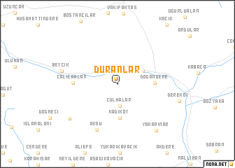
Duranlar (Turkey)Duranlar is a town in Turkey. An overview map of the region around Duranlar is displayed below.
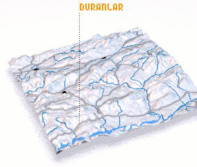
regional and 3d topo map of Duranlar, Turkey ::
Duranlar airports ::
The nearest airport is ESK - Eskisehir, located 80.5 km south west of Duranlar.
Other airports nearby include ANK - Ankara Etimesgut (128.8 km east), ESB - Ankara Esenboga (150.0 km east), AFY - Afyon (183.1 km south), Nearby towns ::
 Places with similar names to Duranlar, Turkey ::
// Duranlar (TR)
// Duranlar (TR)
// Duranlar (TR)
// Torunlar (TR)
// Turanlar (TR)
// Turnalar (TR)
// Tirunallār (IN)
// Tornillar (VE)
// Dār ‘Ayn al ‘Awrāʼ (LB)
// Doornlaar (BE)
Disclaimer :: Information on this page comes without warranty of any kind |
||
|
Where is Duranlar? Elevation and coordinates ::
Latitude (lat): 40°17'53"N Longitude (lon): 31°14'49"E
Elevation (approx.): 923m (map arrows pan, magnifying glasses zoom) |
||
|
Visiting Duranlar? Hotel/Accommodation ::
Book a hotel in Duranlar Travel Guide ::
Buy a travel guide for Turkey rental cars ::
car rental offers GPS waypoint ::
download a GPX waypoint (PoI) of Duranlar for your GPS receiver
|
||