|
search place name
|
||
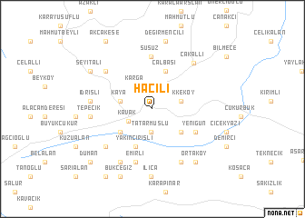
Hacılı (Samsun, Turkey)Hacılı is a town in the Samsun region of Turkey. An overview map of the region around Hacılı is displayed below.
regional and 3d topo map of Hacılı, Turkey ::
Hacılı airports ::
The nearest airport is MZH - Merzifon, located 54.5 km south west of Hacılı.
Other airports nearby include VAS - Sivas (158.6 km south east), Nearby towns ::
Tatarmuslu (2.8km south) //
Kavak (2.7km south west) //
Karga (3.2km north west) //
Tekkeköy (2.8km east) //
Kaya (3.1km west) //
Kurşunlu (3.9km south east) //
Dura (4.1km south west) //
Çalbaşı (4.8km north) //
Yakınçirişli (4.9km south) //
Yenigün (4.9km south east) //
Susuz (6.5km north) //
Emirli (6.7km south) //
Koçalan (6.3km north west) //
Köseli (7.0km south) //
Muratbeyli (6.4km south west) //
Çakallı (6.8km north east) //
Bayındır (7.2km south west) //
İdrisli (5.8km west) //
Tepecik (5.8km west) //
Ilıca (8.4km south) //
Ortaköy (7.7km south east) //
Değirmencili (8.4km north) //
Seyitali (7.4km north west) //
Bükceğiz (8.9km south) //
Duman (8.7km south west) //
Akçakese (9.4km north west) //
Kozansıkı (9.4km south west) //
[all distances 'as the bird flies' and approximate] 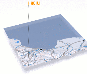 Places with similar names to Hacılı, Turkey ::
Disclaimer :: Information on this page comes without warranty of any kind |
||
|
Where is Hacılı? Elevation and coordinates ::
Latitude (lat): 41°5'31"N Longitude (lon): 36°4'7"E
Elevation (approx.): 740m (map arrows pan, magnifying glasses zoom) |
||
|
Visiting Hacılı? Hotel/Accommodation ::
Book a hotel in Hacılı Travel Guide ::
Buy a travel guide for Turkey rental cars ::
car rental offers GPS waypoint ::
download a GPX waypoint (PoI) of Hacılı for your GPS receiver
|
||