|
search place name
|
||
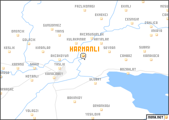
Harmanlı (Bursa, Turkey)Harmanlı is a town in the Bursa region of Turkey. An overview map of the region around Harmanlı is displayed below.
regional and 3d topo map of Harmanlı, Turkey ::
Harmanlı airports ::
The nearest airport is BDM - Bandirma, located 38.1 km west of Harmanlı.
Other airports nearby include BZI - Balikesir (81.6 km south west), IST - Istanbul Ataturk (87.5 km north), MJT - Mytilini Mitilini (204.7 km south west), IGL - Izmir Cigli (227.8 km south west), Nearby towns ::
Çarık (4.0km north) //
Kulakpınar (4.0km north) //
Akçasusurluk (5.1km north) //
Hayırlar (4.7km north east) //
Akçakoyun (4.2km west) //
Ulubat (5.5km south) //
Seyran (4.6km north east) //
Taşlık (4.6km south west) //
Karacabey (6.5km south west) //
Yarış (7.0km north west) //
Güngörmez (8.8km north west) //
[all distances 'as the bird flies' and approximate] 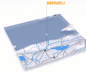 Places with similar names to Harmanlı, Turkey ::
Disclaimer :: Information on this page comes without warranty of any kind |
||
|
Where is Harmanlı? Elevation and coordinates ::
Latitude (lat): 40°15'0"N Longitude (lon): 28°25'0"E
Elevation (approx.): 54m (map arrows pan, magnifying glasses zoom) |
||
|
Visiting Harmanlı? Hotel/Accommodation ::
Book a hotel in Harmanlı Travel Guide ::
Buy a travel guide for Turkey rental cars ::
car rental offers GPS waypoint ::
download a GPX waypoint (PoI) of Harmanlı for your GPS receiver
|
||