|
search place name
|
||
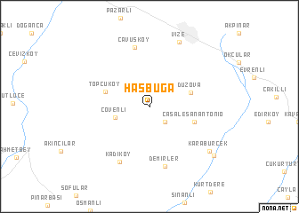
Hasbuğa (Kırklareli, Turkey)Hasbuğa is a town in the Kırklareli region of Turkey. An overview map of the region around Hasbuğa is displayed below.
regional and 3d topo map of Hasbuğa, Turkey ::
Hasbuğa airports ::
The nearest airport is IST - Istanbul Ataturk, located 107.7 km south east of Hasbuğa.
Other airports nearby include BOJ - Bourgas Burgas (120.2 km north), BDM - Bandirma (132.9 km south), AXD - Alexandroupolis Dimokritos (165.4 km south west), VAR - Varna (192.5 km north), Nearby towns ::
Müsellim (2.3km south east) //
Çövenli (3.5km south west) //
Düzova (4.2km north east) //
Casale San Antonio (4.6km south east) //
Topçuköy (4.6km north west) //
Develi (7.5km north) //
Çavuşköy (7.5km north) //
Demirler (7.5km south) //
Kadıköy (7.5km south) //
Vize (8.5km north) //
Karabürçek (7.9km south east) //
Yuvalı (8.5km south east) //
[all distances 'as the bird flies' and approximate] 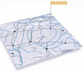 Places with similar names to Hasbuğa, Turkey ::
Disclaimer :: Information on this page comes without warranty of any kind |
||
|
Where is Hasbuğa? Elevation and coordinates ::
Latitude (lat): 41°30'0"N Longitude (lon): 27°44'0"E
Elevation (approx.): 174m (map arrows pan, magnifying glasses zoom) |
||
|
Visiting Hasbuğa? Hotel/Accommodation ::
Book a hotel in Hasbuğa Travel Guide ::
Buy a travel guide for Turkey rental cars ::
car rental offers GPS waypoint ::
download a GPX waypoint (PoI) of Hasbuğa for your GPS receiver
|
||