|
search place name
|
||
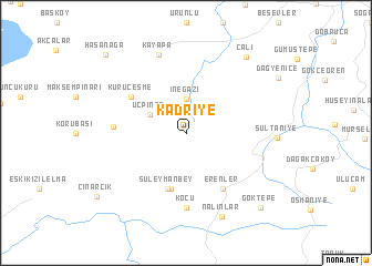
Kadriye (Bursa, Turkey)Kadriye is a town in the Bursa region of Turkey. An overview map of the region around Kadriye is displayed below.
regional and 3d topo map of Kadriye, Turkey ::
Kadriye airports ::
The nearest airport is BDM - Bandirma, located 79.5 km west of Kadriye.
Other airports nearby include BZI - Balikesir (96.6 km south west), IST - Istanbul Ataturk (97.5 km north), ESK - Eskisehir (150.7 km east), AFY - Afyon (213.5 km south east), Nearby towns ::
İnegazi (3.4km north) //
Üçpınar (3.4km north west) //
Başköy (5.7km south) //
Süleymanbey (5.7km south) //
Kuruçeşme (5.6km north west) //
Erenler (6.2km south east) //
Güngören (5.7km west) //
Koçu (7.4km south) //
Kayapa (8.2km north) //
Nalınlar (8.7km south) //
Çalı (8.9km north east) //
Göktepe (9.3km south east) //
Hasanağa (10.0km north west) //
[all distances 'as the bird flies' and approximate] 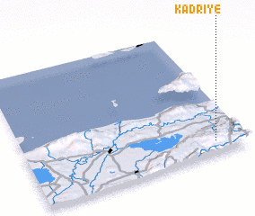 Places with similar names to Kadriye, Turkey ::
// Kadriye (TR)
// Kadriye (TR)
// Kadareya (RU)
// Kotaraya (ID)
// Kotaraya (ID)
// Kotorayo (ID)
// Katiriyo (UG)
// Kutayrāyah (SD)
// Kutayrāyah (SD)
// Qaţrū'īyeh (IR)
Disclaimer :: Information on this page comes without warranty of any kind |
||
|
Where is Kadriye? Elevation and coordinates ::
Latitude (lat): 40°6'0"N Longitude (lon): 28°52'0"E
Elevation (approx.): 636m (map arrows pan, magnifying glasses zoom) |
||
|
Visiting Kadriye? Hotel/Accommodation ::
Book a hotel in Kadriye Travel Guide ::
Buy a travel guide for Turkey rental cars ::
car rental offers GPS waypoint ::
download a GPX waypoint (PoI) of Kadriye for your GPS receiver
|
||