|
search place name
|
||
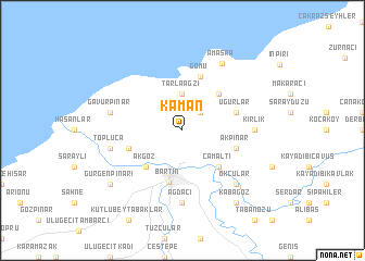
Kaman (Turkey)Kaman is a town in Turkey. An overview map of the region around Kaman is displayed below.
regional and 3d topo map of Kaman, Turkey ::
Kaman airports ::
The nearest airport is ESB - Ankara Esenboga, located 181.1 km south of Kaman.
Other airports nearby include ANK - Ankara Etimesgut (194.6 km south), ESK - Eskisehir (258.4 km south west), Nearby towns ::
Kazpınarı (2.3km north east) //
Tarlaağzı (3.7km north) //
Çamaltı (4.6km south east) //
Akgöz (4.6km south west) //
Bostanlar (4.6km north east) //
Bartın (5.4km south) //
Akpınar (4.5km south east) //
Kalaycı (4.5km south west) //
Gömü (5.7km north) //
Uğurlar (4.5km north east) //
Ağdacı (7.4km south) //
Kirlik (5.5km east) //
Topluca (5.8km west) //
Gâvurpınar (5.8km west) //
Okçular (6.9km south east) //
Amasra (7.5km north east) //
Kabagöz (8.5km south east) //
Gürgenpınarı (7.8km south west) //
[all distances 'as the bird flies' and approximate]  Places with similar names to Kaman, Turkey ::
Disclaimer :: Information on this page comes without warranty of any kind |
||
|
Where is Kaman? Elevation and coordinates ::
Latitude (lat): 41°41'0"N Longitude (lon): 32°21'0"E
Elevation (approx.): 147m (map arrows pan, magnifying glasses zoom) |
||
|
Visiting Kaman? Hotel/Accommodation ::
Book a hotel in Kaman Travel Guide ::
Buy a travel guide for Turkey rental cars ::
car rental offers GPS waypoint ::
download a GPX waypoint (PoI) of Kaman for your GPS receiver
|
||