|
search place name
|
||
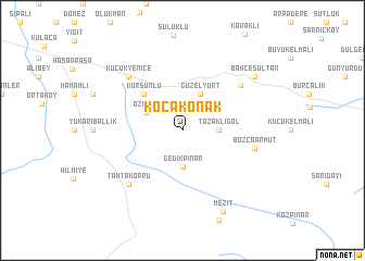
Kocakonak (Bursa, Turkey)Kocakonak is a town in the Bursa region of Turkey. An overview map of the region around Kocakonak is displayed below.
regional and 3d topo map of Kocakonak, Turkey ::
Kocakonak airports ::
The nearest airport is ESK - Eskisehir, located 79.2 km east of Kocakonak.
Other airports nearby include IST - Istanbul Ataturk (131.9 km north west), BDM - Bandirma (150.9 km west), BZI - Balikesir (157.7 km west), AFY - Afyon (161.3 km south east), Nearby towns ::
Hamitabat (2.8km east) //
Tozaklıgöl (2.8km east) //
Gedikpınar (3.7km south) //
Özlüce (3.4km north west) //
Güzelyurt (4.0km north) //
Kurşunlu (4.8km north west) //
Nazifpaşa (6.5km north east) //
Bozcaarmut (6.0km east) //
Küçükyenice (7.0km north west) //
Eymir (7.0km north west) //
Tahtaköprü (7.0km south west) //
Bahçesultan (7.9km north east) //
Mezit (8.9km south) //
[all distances 'as the bird flies' and approximate] 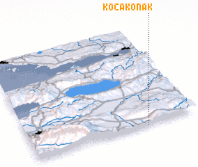 Places with similar names to Kocakonak, Turkey ::
// Küçükkonak (TR)
// Kgokong (ZA)
// Kakikangu (CD)
// Gagaganga (TZ)
// Gqukunqa (ZA)
// K'o-k'o-kang (TW)
// K'o-k'o-k'eng (TW)
// Cốc Càng (VN)
// Cóc Công (VN)
// Kaikukang (CN)
Disclaimer :: Information on this page comes without warranty of any kind |
||
|
Where is Kocakonak? Elevation and coordinates ::
Latitude (lat): 40°0'0"N Longitude (lon): 29°42'0"E
Elevation (approx.): 703m (map arrows pan, magnifying glasses zoom) |
||
|
Visiting Kocakonak? Hotel/Accommodation ::
Book a hotel in Kocakonak Travel Guide ::
Buy a travel guide for Turkey rental cars ::
car rental offers GPS waypoint ::
download a GPX waypoint (PoI) of Kocakonak for your GPS receiver
|
||