|
search place name
|
||
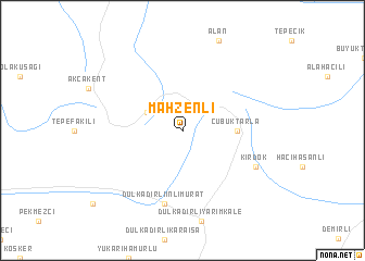
Mahzenli (Kırşehir, Turkey)Mahzenli is a town in the Kırşehir region of Turkey. An overview map of the region around Mahzenli is displayed below.
regional and 3d topo map of Mahzenli, Turkey ::
Mahzenli airports ::
The nearest airport is ESB - Ankara Esenboga, located 118.3 km north west of Mahzenli.
Other airports nearby include ANK - Ankara Etimesgut (134.4 km west), ASR - Kayseri Erkilet (144.9 km south east), MZH - Merzifon (179.2 km north east), KYA - Konya (227.1 km south west), Nearby towns ::
Kösefakılı (3.4km north west) //
Çubuktarla (4.3km east) //
Dulkadirliinlimurat (7.5km south) //
Kırdök (6.8km south east) //
[all distances 'as the bird flies' and approximate]  Places with similar names to Mahzenli, Turkey ::
// Maşanlı (AZ)
// Maison Leh (LU)
// Mežionėliai (LT)
// Misinli (TR)
// Mosanlū (IR)
// Maḩsanlī (SY)
// Missanello (IT)
// Maisnil (FR)
// Maisnil (FR)
// Meysonial (FR)
Disclaimer :: Information on this page comes without warranty of any kind |
||
|
Where is Mahzenli? Elevation and coordinates ::
Latitude (lat): 39°35'0"N Longitude (lon): 34°11'0"E
Elevation (approx.): 1349m (map arrows pan, magnifying glasses zoom) |
||
|
Visiting Mahzenli? Hotel/Accommodation ::
Book a hotel in Mahzenli Travel Guide ::
Buy a travel guide for Turkey rental cars ::
car rental offers GPS waypoint ::
download a GPX waypoint (PoI) of Mahzenli for your GPS receiver
|
||