|
search place name
|
||
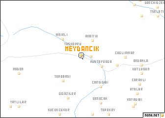
Meydancık (Artvin, Turkey)Meydancık is a town in the Artvin region of Turkey. An overview map of the region around Meydancık is displayed below.
regional and 3d topo map of Meydancık, Turkey ::
Meydancık airports ::
The nearest airport is ERZ - Erzurum, located 185.5 km south west of Meydancık.
Nearby towns ::
Balıklı (1.5km north east) //
Taşköprü (2.9km north west) //
Mustafaağa (3.6km south east) //
Akbıyık (4.5km north) //
Mısırlı (5.7km north west) //
Tepebaşı (5.9km south west) //
Çarşıdibi (6.9km south east) //
Çatalçam (6.0km east) //
Gigaziler (9.2km south) //
[all distances 'as the bird flies' and approximate] 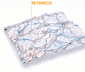 Places with similar names to Meydancık, Turkey ::
// Matanuska (US)
// Mioduńskie (PL)
// Mediniškiai (LT)
// Mitėniškiai (LT)
// Meydancık (TR)
// Meydancık (TR)
// Meydancık (TR)
// Meydancık (TR)
// Myyutinskiy (RU)
// Madina Sako (ML)
Disclaimer :: Information on this page comes without warranty of any kind |
||
|
Where is Meydancık? Elevation and coordinates ::
Latitude (lat): 41°24'45"N Longitude (lon): 42°14'48"E
Elevation (approx.): 1282m (map arrows pan, magnifying glasses zoom) |
||
|
Visiting Meydancık? Hotel/Accommodation ::
Book a hotel in Meydancık Travel Guide ::
Buy a travel guide for Turkey rental cars ::
car rental offers GPS waypoint ::
download a GPX waypoint (PoI) of Meydancık for your GPS receiver
|
||