|
search place name
|
||
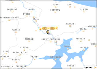
Sarıpınar (İstanbul, Turkey)Sarıpınar is a town in the İstanbul region of Turkey. An overview map of the region around Sarıpınar is displayed below.
regional and 3d topo map of Sarıpınar, Turkey ::
Sarıpınar airports ::
The nearest airport is IST - Istanbul Ataturk, located 45.2 km west of Sarıpınar.
Other airports nearby include BDM - Bandirma (143.4 km south west), ESK - Eskisehir (181.2 km south east), BZI - Balikesir (203.2 km south west), BOJ - Bourgas Burgas (221.6 km north west), Nearby towns ::
Mahmut Şevket Paşa (2.8km south) //
Koçullu (3.5km south east) //
Hüseyinli (3.8km north west) //
Kılıçlı (6.3km north west) //
Reşadiye (6.2km south west) //
Bozhane (8.1km north west) //
Avcıkoru (7.1km north east) //
Karakiraz (8.8km north) //
Esenceli (7.9km south east) //
Öyümce (9.5km north west) //
Göllü (10.2km north west) //
[all distances 'as the bird flies' and approximate] 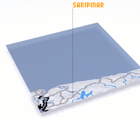 Places with similar names to Sarıpınar, Turkey ::
// Sarıpınar (TR)
// Sarıpınar (TR)
// Sarıpınar (TR)
// Sarıpınar (TR)
// Sarıpınar (TR)
// Sarıpınar (TR)
// Sarıpınar (TR)
// Sare Pānre (PK)
// Sar Pānre (PK)
// Soripai Narai (PK)
Disclaimer :: Information on this page comes without warranty of any kind |
||
|
Where is Sarıpınar? Elevation and coordinates ::
Latitude (lat): 41°6'12"N Longitude (lon): 29°19'32"E
Elevation (approx.): 51m (map arrows pan, magnifying glasses zoom) |
||
|
Visiting Sarıpınar? Hotel/Accommodation ::
Book a hotel in Sarıpınar Travel Guide ::
Buy a travel guide for Turkey rental cars ::
car rental offers GPS waypoint ::
download a GPX waypoint (PoI) of Sarıpınar for your GPS receiver
|
||