|
search place name
|
||
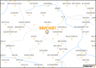
Savcıköy (Tokat, Turkey)Savcıköy is a town in the Tokat region of Turkey. An overview map of the region around Savcıköy is displayed below.
regional and 3d topo map of Savcıköy, Turkey ::
Savcıköy airports ::
The nearest airport is MZH - Merzifon, located 69.5 km north of Savcıköy.
Other airports nearby include VAS - Sivas (103.4 km south east), ASR - Kayseri Erkilet (166.8 km south), Nearby towns ::
Osmaniye (2.3km south east) //
Palanlı (3.7km north) //
Kurupınar (2.8km east) //
Hacılar (3.4km north east) //
Yeşilce (4.7km south west) //
Üçköy (4.6km south west) //
Kurşunlu (4.6km north east) //
Akgüller (5.6km north west) //
Belpınar (5.6km south east) //
Belkaya (6.2km south east) //
Taşkıran (7.5km south) //
Kepez (7.5km north) //
Alayurt (7.9km south) //
Zile (7.4km north east) //
Boztepe (8.3km south east) //
Yalnız (9.3km north west) //
[all distances 'as the bird flies' and approximate] 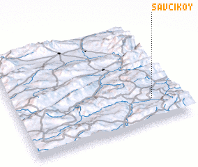 Places with similar names to Savcıköy, Turkey ::
Disclaimer :: Information on this page comes without warranty of any kind |
||
|
Where is Savcıköy? Elevation and coordinates ::
Latitude (lat): 40°15'0"N Longitude (lon): 35°50'0"E
Elevation (approx.): 957m (map arrows pan, magnifying glasses zoom) |
||
|
Visiting Savcıköy? Hotel/Accommodation ::
Book a hotel in Savcıköy Travel Guide ::
Buy a travel guide for Turkey rental cars ::
car rental offers GPS waypoint ::
download a GPX waypoint (PoI) of Savcıköy for your GPS receiver
|
||