|
search place name
|
||
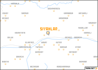
Siyahlar (Kastamonu, Turkey)Siyahlar is a town in the Kastamonu region of Turkey. An overview map of the region around Siyahlar is displayed below.
regional and 3d topo map of Siyahlar, Turkey ::
Siyahlar airports ::
The nearest airport is ESB - Ankara Esenboga, located 157.8 km south of Siyahlar.
Other airports nearby include ANK - Ankara Etimesgut (184.8 km south), Nearby towns ::
Dereköy (1.4km west) //
Daday (4.0km south) //
Davut (4.0km south) //
Demirciler (3.3km north east) //
Boyalılar (4.6km south west) //
Küten (4.6km south east) //
Tüfekçi (6.2km south west) //
Kayıköy (6.2km south east) //
İnciğez (5.9km east) //
Hasanağa (6.9km north east) //
Sorkun (6.9km south east) //
Elmayazı (6.7km south west) //
Dereköy (7.9km south) //
Akpınar (7.9km south west) //
Hasanşeyh (9.3km south east) //
Karaboğa (9.3km north east) //
[all distances 'as the bird flies' and approximate] 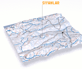
Disclaimer :: Information on this page comes without warranty of any kind |
||
|
Where is Siyahlar? Elevation and coordinates ::
Latitude (lat): 41°30'0"N Longitude (lon): 33°29'0"E
Elevation (approx.): 883m (map arrows pan, magnifying glasses zoom) |
||
|
Visiting Siyahlar? Hotel/Accommodation ::
Book a hotel in Siyahlar Travel Guide ::
Buy a travel guide for Turkey rental cars ::
car rental offers GPS waypoint ::
download a GPX waypoint (PoI) of Siyahlar for your GPS receiver
|
||