|
search place name
|
||
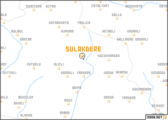
Sulakdere (Turkey)Sulakdere is a town in Turkey. An overview map of the region around Sulakdere is displayed below.
regional and 3d topo map of Sulakdere, Turkey ::
Sulakdere airports ::
The nearest airport is BAL - Batman, located 74.4 km north of Sulakdere.
Other airports nearby include DIY - Diyabakir Diyarbakir (98.1 km north west), EZS - Elazig (210.4 km north west), DEZ - Deire Zor Deir Zzor (231.5 km south), Nearby towns ::
Yardere (3.7km south) //
Konaklı (4.7km south west) //
Küçükkardeş (4.4km east) //
Büyükkardeş (4.4km east) //
Alıçlı (4.8km south west) //
İkipınar (6.3km north west) //
Konuk (5.8km south east) //
Brīfā (7.2km south) //
Taşlıca (7.4km north) //
Heybeli (7.1km north east) //
Kaynakkaya (8.6km north west) //
Akarsu (7.7km south east) //
[all distances 'as the bird flies' and approximate] 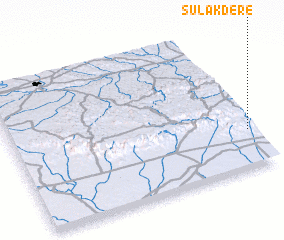 Places with similar names to Sulakdere, Turkey ::
// Z̄ū ol Qadr (IR)
// Z̄ū ol Qadr (IR)
// Salak Dāhri (PK)
// Zulqādir (PK)
// Zule Kederi (SD)
// Seligdar (RU)
// Seligdar (RU)
// Sullcatiri (BO)
// Salgotier (FR)
// Saligottière (FR)
Disclaimer :: Information on this page comes without warranty of any kind |
||
|
Where is Sulakdere? Elevation and coordinates ::
Latitude (lat): 37°16'0"N Longitude (lon): 40°59'0"E
Elevation (approx.): 879m (map arrows pan, magnifying glasses zoom) |
||
|
Visiting Sulakdere? Hotel/Accommodation ::
Book a hotel in Sulakdere Travel Guide ::
Buy a travel guide for Turkey rental cars ::
car rental offers GPS waypoint ::
download a GPX waypoint (PoI) of Sulakdere for your GPS receiver
|
||