|
search place name
|
||
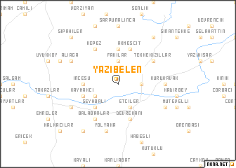
Yazıbelen (Kastamonu, Turkey)Yazıbelen is a town in the Kastamonu region of Turkey. An overview map of the region around Yazıbelen is displayed below.
regional and 3d topo map of Yazıbelen, Turkey ::
Yazıbelen airports ::
The nearest airport is MZH - Merzifon, located 169.5 km south east of Yazıbelen.
Other airports nearby include ESB - Ankara Esenboga (182.6 km south), ANK - Ankara Etimesgut (211.4 km south west), Nearby towns ::
Bozkoca (2.8km east) //
Fakılar (3.7km north) //
Etçiler (4.0km south) //
Bozkocatepe (3.3km north east) //
Delihacılar (3.3km south west) //
Şeyhbali (4.6km south west) //
İncesu (4.2km west) //
Karayazıcılar (5.6km north) //
Devrekâni (5.7km south) //
Akmescit (5.7km north) //
Kaymakçı (4.5km south west) //
Tekkekızıllar (5.6km north east) //
Balabanlar (6.2km south west) //
Kepez (6.2km north west) //
Kurukavak (5.5km east) //
Yolyaka (7.5km south) //
Kasaplar (6.7km south east) //
Seydiler (6.7km south west) //
Aliağa (6.7km north west) //
Yaylaköy (8.5km south west) //
Karaçam (8.5km north east) //
Sipahiler (9.3km north west) //
[all distances 'as the bird flies' and approximate] 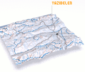 Places with similar names to Yazıbelen, Turkey ::
Disclaimer :: Information on this page comes without warranty of any kind |
||
|
Where is Yazıbelen? Elevation and coordinates ::
Latitude (lat): 41°39'0"N Longitude (lon): 33°49'0"E
Elevation (approx.): 1166m (map arrows pan, magnifying glasses zoom) |
||
|
Visiting Yazıbelen? Hotel/Accommodation ::
Book a hotel in Yazıbelen Travel Guide ::
Buy a travel guide for Turkey rental cars ::
car rental offers GPS waypoint ::
download a GPX waypoint (PoI) of Yazıbelen for your GPS receiver
|
||