|
search place name
|
||
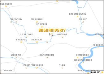
Bogdanivskiy (Ukraine)Bogdanivskiy is a town in Ukraine. An overview map of the region around Bogdanivskiy is displayed below.
regional and 3d topo map of Bogdanivskiy, Ukraine ::
Bogdanivskiy airports ::
The nearest airport is ODS - Odessa Odesa Intl, located 145.2 km south of Bogdanivskiy.
Nearby towns ::
Koshtov-Khutor (2.2km south west) //
Anetovka (2.5km east) //
Velikovka (4.5km north west) //
Novosëlki (4.2km south west) //
Khutor Zabara (7.5km south) //
Semikhatka (6.7km north west) //
[all distances 'as the bird flies' and approximate] 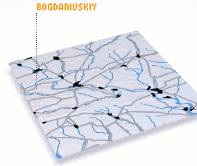 Places with similar names to Bogdanivskiy, Ukraine ::
// Bogdanovskiy (UA)
// Bogdanovskiy (UA)
// Bogdanovskiy (RU)
// Bogdanovskiy (RU)
// Bogdanovskiy (RU)
// Bogdanovskiy (RU)
// Bogdanovskiy (RU)
// Bogdanovskiy (RU)
// Bogdanovskiy (RU)
// Bogdanovskiy (KZ)
Disclaimer :: Information on this page comes without warranty of any kind |
||
|
Where is Bogdanivskiy? Elevation and coordinates ::
Latitude (lat): 47°42'0"N Longitude (lon): 31°6'0"E
Elevation (approx.): 45m (map arrows pan, magnifying glasses zoom) |
||
|
Visiting Bogdanivskiy? Hotel/Accommodation ::
Book a hotel in Bogdanivskiy Travel Guide ::
Buy a travel guide for Ukraine rental cars ::
car rental offers GPS waypoint ::
download a GPX waypoint (PoI) of Bogdanivskiy for your GPS receiver
|
||