|
search place name
|
||
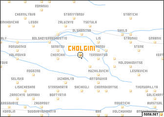
Cholgini (Ukraine)Cholgini is a town in Ukraine. An overview map of the region around Cholgini is displayed below.
regional and 3d topo map of Cholgini, Ukraine ::
Cholgini airports ::
The nearest airport is LWO - Lvov Lviv Intl, located 37.7 km east of Cholgini.
Other airports nearby include RZE - Rzeszow Jasionka (105.2 km west), Nearby towns ::
Prilbichi (2.2km south east) //
Ternovitsa (2.4km east) //
Romanov (3.0km north east) //
Muzhilovichi (4.4km south east) //
Lis (4.4km north east) //
Cherchik (3.6km west) //
Olʼshanitsa (5.6km north) //
Senatov (4.0km north west) //
Gnoyno (4.0km north east) //
Vizhomlya (6.1km south west) //
Antonuvka (6.1km south east) //
Shchegli (7.4km south) //
Novosyulki (7.4km south) //
Podluby (4.8km east) //
Tsetula (7.5km north) //
Berdykhov (5.1km east) //
Maloye Predmestʼye (6.6km north west) //
Zaluzhʼye (7.8km north) //
Bolʼshoye Predmestʼye (6.0km north west) //
Lyashki (7.8km south) //
Yavoriv (6.0km north west) //
Chernokonʼtse (8.2km south east) //
Strashnaya (8.2km south west) //
[all distances 'as the bird flies' and approximate]  Places with similar names to Cholgini, Ukraine ::
Disclaimer :: Information on this page comes without warranty of any kind |
||
|
Where is Cholgini? Elevation and coordinates ::
Latitude (lat): 49°54'0"N Longitude (lon): 23°27'0"E
Elevation (approx.): 245m (map arrows pan, magnifying glasses zoom) |
||
|
Visiting Cholgini? Hotel/Accommodation ::
Book a hotel in Cholgini Travel Guide ::
Buy a travel guide for Ukraine rental cars ::
car rental offers GPS waypoint ::
download a GPX waypoint (PoI) of Cholgini for your GPS receiver
|
||