|
search place name
|
||
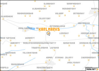
Karl-Marks (Ukraine)Karl-Marks is a town in Ukraine. An overview map of the region around Karl-Marks is displayed below.
regional and 3d topo map of Karl-Marks, Ukraine ::
Karl-Marks airports ::
The nearest airport is DNK - Dnepropetrovsk Dnipropetrovsk Intl, located 70.2 km north west of Karl-Marks.
Other airports nearby include DOK - Donetsk Intl (149.8 km east), Nearby towns ::
Podgornoye (2.2km north east) //
Petropavlovka (3.3km north east) //
Matsko (3.1km north west) //
Nikolayevka Nomer Odinnadtsatyy (4.5km south west) //
Leninskiy (3.7km east) //
Listovka (5.7km south) //
Zelënyy Gay (5.7km north) //
Trudoyelenovka (6.1km south west) //
Ukromnyy (5.3km west) //
Sergeyevka (6.2km south east) //
Volʼdorf (7.8km north) //
Veselyy Hay (8.6km north east) //
Yelizavetovka (8.9km south west) //
Antonovka (8.9km north west) //
[all distances 'as the bird flies' and approximate] 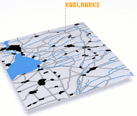 Places with similar names to Karl-Marks, Ukraine ::
// Karla Marksa (UA)
// Karla Marksa (UA)
// Karla Marksa (RU)
// Karla Marksa (RU)
// Karla Marksa (RU)
// Karla Marksa (RU)
// Karla Marksa (RU)
// Karla Marksa (RU)
// Karla Marksa (RU)
// Karla Marksa (RU)
Disclaimer :: Information on this page comes without warranty of any kind |
||
|
Where is Karl-Marks? Elevation and coordinates ::
Latitude (lat): 47°54'0"N Longitude (lon): 35°45'0"E
Elevation (approx.): 136m (map arrows pan, magnifying glasses zoom) |
||
|
Visiting Karl-Marks? Hotel/Accommodation ::
Book a hotel in Karl-Marks Travel Guide ::
Buy a travel guide for Ukraine rental cars ::
car rental offers GPS waypoint ::
download a GPX waypoint (PoI) of Karl-Marks for your GPS receiver
|
||