|
search place name
|
||
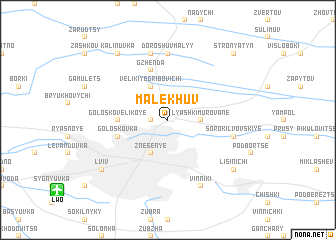
Malekhuv (Ukraine)Malekhuv is a town in Ukraine. An overview map of the region around Malekhuv is displayed below.
regional and 3d topo map of Malekhuv, Ukraine ::
Malekhuv airports ::
The nearest airport is LWO - Lvov Lviv Intl, located 11.2 km south west of Malekhuv.
Nearby towns ::
Zboyska (1.2km west) //
Dublyany (2.2km north east) //
Lyashki Murovane (2.4km east) //
Znesenʼye (3.9km south) //
Velikiye Gribovichi (3.9km north) //
Golosko-Velikoye (3.6km west) //
Golosko-Maloye (4.0km south west) //
Goloskovka (4.0km south west) //
Gzhenda (5.7km north) //
Doroshuv Malyy (7.4km north) //
Soroki-Lʼvovskiye (5.1km east) //
Doroshuv Velikiy (7.5km north) //
Vinniki (7.8km south) //
Lisinichi (7.3km south east) //
Lʼviv (7.3km south west) //
Kalinuvka (8.2km north west) //
Stronyatyn (8.8km north east) //
[all distances 'as the bird flies' and approximate] 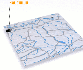 Places with similar names to Malekhuv, Ukraine ::
Disclaimer :: Information on this page comes without warranty of any kind |
||
|
Where is Malekhuv? Elevation and coordinates ::
Latitude (lat): 49°53'0"N Longitude (lon): 24°4'0"E
Elevation (approx.): 272m (map arrows pan, magnifying glasses zoom) |
||
|
Visiting Malekhuv? Hotel/Accommodation ::
Book a hotel in Malekhuv Travel Guide ::
Buy a travel guide for Ukraine rental cars ::
car rental offers GPS waypoint ::
download a GPX waypoint (PoI) of Malekhuv for your GPS receiver
|
||