|
search place name
|
||
Seretets (Ukraine)Seretets is a town in Ukraine. An overview map of the region around Seretets is displayed below.
regional and 3d topo map of Seretets, Ukraine ::

Seretets airports ::
The nearest airport is LWO - Lvov Lviv Intl, located 102.8 km west of Seretets.
Nearby towns ::
Verzhbovchik (1.2km east) //
Kutyshche (2.2km north west) //
Zagorʼye (2.4km east) //
Zagarʼye (2.4km east) //
Gaye za Rudon (3.7km south) //
Podberezhtse (3.0km south west) //
Nizhkovtse (3.0km north east) //
Panasovka (4.0km north east) //
Gaye Roztotskoye (5.7km south) //
Palikorovy (6.1km north west) //
Chistopady (6.1km south west) //
Gai-Rastotskiye (6.1km south east) //
Verbovchik (4.8km west) //
Zalozhtsy-Nove (7.4km south) //
Nemyach (7.5km north) //
Styberivka (6.0km north west) //
Blikh (8.2km south east) //
Podkamenʼ (8.8km north west) //
[all distances 'as the bird flies' and approximate] 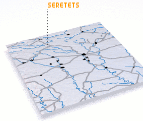 Places with similar names to Seretets, Ukraine ::
// Sredets (BG)
// Sredets (BG)
// Sredets (BG)
// Sreditsa (BG)
// Ciritdüzü (TR)
// Serditsa (UA)
// Zarudtsy (UA)
// Sierra de Outes (ES)
// Cerreto dʼEsi (IT)
// Serdtse (RU)
Disclaimer :: Information on this page comes without warranty of any kind |
||
|
Where is Seretets? Elevation and coordinates ::
Latitude (lat): 49°52'0"N Longitude (lon): 25°23'0"E
Elevation (approx.): 326m (map arrows pan, magnifying glasses zoom) |
||
|
Visiting Seretets? Hotel/Accommodation ::
Book a hotel in Seretets Travel Guide ::
Buy a travel guide for Ukraine rental cars ::
car rental offers GPS waypoint ::
download a GPX waypoint (PoI) of Seretets for your GPS receiver
|
||