|
search place name
|
||
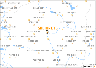
Shchirets (Ukraine)Shchirets is a town in Ukraine. An overview map of the region around Shchirets is displayed below.
regional and 3d topo map of Shchirets, Ukraine ::
Shchirets airports ::
The nearest airport is LWO - Lvov Lviv Intl, located 19.2 km north of Shchirets.
Other airports nearby include RZE - Rzeszow Jasionka (142.3 km west), BAY - Baia Mare Tautii Magheraus (223.4 km south), SUJ - Satu Mare (228.2 km south), Nearby towns ::
Ostruv (1.9km north) //
Lany (1.9km south) //
Nikonkovichi (3.6km west) //
Pyaski (4.0km south east) //
Semenovka (4.0km north east) //
Gumenets (5.2km south west) //
Serditsa (5.2km north west) //
Malinuvka (6.1km north west) //
Dmitre (7.5km south) //
Mostki (7.5km north) //
Yastzhembkuv (5.1km west) //
Sroki (5.1km west) //
Gorbachi (6.6km south east) //
Miloshovitse (6.1km north east) //
Cherkasy (7.8km south) //
Lesnevichi (7.8km north) //
Volitsa (7.8km north) //
Velikaya Gorozhanka (7.8km south) //
Pustomyty (8.2km north east) //
Koloniya Dembyanka (7.3km north west) //
[all distances 'as the bird flies' and approximate] 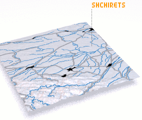 Places with similar names to Shchirets, Ukraine ::
// Shcherets (UA)
Disclaimer :: Information on this page comes without warranty of any kind |
||
|
Where is Shchirets? Elevation and coordinates ::
Latitude (lat): 49°39'0"N Longitude (lon): 23°52'0"E
Elevation (approx.): 264m (map arrows pan, magnifying glasses zoom) |
||
|
Visiting Shchirets? Hotel/Accommodation ::
Book a hotel in Shchirets Travel Guide ::
Buy a travel guide for Ukraine rental cars ::
car rental offers GPS waypoint ::
download a GPX waypoint (PoI) of Shchirets for your GPS receiver
|
||