|
search place name
|
||
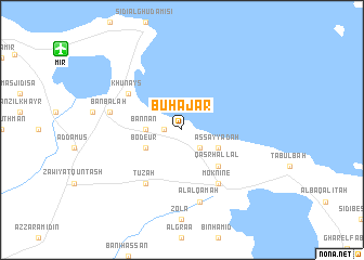
Bū Ḩajar (Monastir, Tunisia)Bū Ḩajar is a town in the Monastir region of Tunisia. An overview map of the region around Bū Ḩajar is displayed below.
regional and 3d topo map of Bū Ḩajar, Tunisia ::
Bū Ḩajar airports ::
The nearest airport is MIR - Monastir Habib Bourguiba Intl, located 13.1 km north west of Bū Ḩajar.
Other airports nearby include SFA - Sfax Thyna (108.3 km south), TUN - Tunis Carthage (141.7 km north west), LMP - Lampedusa (160.1 km east), PNL - Pantelleria (160.1 km north east), Nearby towns ::
Quşaybat al Madyūnī (1.5km west) //
Lamţah (2.4km south east) //
Bannān (3.0km west) //
Aş Şayyādah (3.5km south east) //
Bodeur (3.5km south west) //
Qaşr Hallāl (4.8km south east) //
Moknine (6.3km south east) //
Khunays (5.8km north west) //
Ţūzah (6.3km south west) //
Al ‘Alqamah (7.6km south) //
Banbalah (6.3km west) //
[all distances 'as the bird flies' and approximate] 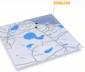 Places with similar names to Bū Ḩajar, Tunisia ::
Disclaimer :: Information on this page comes without warranty of any kind |
||
|
Where is Bū Ḩajar? Elevation and coordinates ::
Latitude (lat): 35°41'0"N Longitude (lon): 10°52'0"E
Elevation (approx.): -32768m (map arrows pan, magnifying glasses zoom) |
||
|
Visiting Bū Ḩajar? Hotel/Accommodation ::
Book a hotel in Bū Ḩajar Travel Guide ::
Buy a travel guide for Tunisia rental cars ::
car rental offers GPS waypoint ::
download a GPX waypoint (PoI) of Bū Ḩajar for your GPS receiver
|
||