|
search place name
|
||
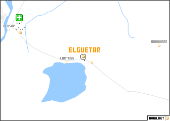
El Guetar (Gafsa, Tunisia)El Guetar is a town in the Gafsa region of Tunisia. An overview map of the region around El Guetar is displayed below.
regional and 3d topo map of El Guetar, Tunisia ::
El Guetar airports ::
The nearest airport is GAF - Gafsa, located 15.2 km north west of El Guetar.
Other airports nearby include TOE - Tozeur Nefta (89.3 km south west), GAE - Gabes (117.8 km south east), TEE - Tebessa Cheikh Larbi Tebessi (143.3 km north west), SFA - Sfax Thyna (165.1 km east), Nearby towns ::
 Places with similar names to El Guetar, Tunisia ::
// El Khtoura (MA)
// Electra (US)
// Electra (US)
// Elkader (US)
// Elkader (US)
// El Cutarro (PA)
// El Aguadero (ES)
// El Cuadro (ES)
// El Cuadro (ES)
// Electra (US)
Disclaimer :: Information on this page comes without warranty of any kind |
||
|
Where is El Guetar? Elevation and coordinates ::
Latitude (lat): 34°20'14"N Longitude (lon): 8°57'10"E
Elevation (approx.): 242m (map arrows pan, magnifying glasses zoom) |
||
|
Visiting El Guetar? Hotel/Accommodation ::
Book a hotel in El Guetar Travel Guide ::
Buy a travel guide for Tunisia rental cars ::
car rental offers GPS waypoint ::
download a GPX waypoint (PoI) of El Guetar for your GPS receiver
|
||