|
search place name
|
||
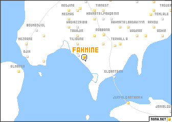
Fahmine (Médenine, Tunisia)Fahmine is a town in the Médenine region of Tunisia. An overview map of the region around Fahmine is displayed below.
regional and 3d topo map of Fahmine, Tunisia ::
Fahmine airports ::
The nearest airport is DJE - Djerba Zarzis, located 19.5 km north west of Fahmine.
Other airports nearby include GAE - Gabes (72.9 km west), SFA - Sfax Thyna (112.2 km north), LMP - Lampedusa (254.6 km north east), Nearby towns ::
Guellala (1.8km north west) //
Al Khāwī (2.4km north west) //
Tilioune (4.0km north west) //
Tafertasset (4.8km north east) //
Al Karāshiwah (5.8km north) //
Ţawājin (5.8km north) //
Robbana (6.6km north east) //
El Qantara (6.2km south east) //
Sedouikch (6.3km north east) //
Wādī az Zabīb (7.6km north) //
Terhalla (7.2km north east) //
Aouru (8.0km north west) //
Al Ḩāzim (9.6km north east) //
[all distances 'as the bird flies' and approximate]  Places with similar names to Fahmine, Tunisia ::
Disclaimer :: Information on this page comes without warranty of any kind |
||
|
Where is Fahmine? Elevation and coordinates ::
Latitude (lat): 33°43'0"N Longitude (lon): 10°52'0"E
Elevation (approx.): 25m (map arrows pan, magnifying glasses zoom) |
||
|
Visiting Fahmine? Hotel/Accommodation ::
Book a hotel in Fahmine Travel Guide ::
Buy a travel guide for Tunisia rental cars ::
car rental offers GPS waypoint ::
download a GPX waypoint (PoI) of Fahmine for your GPS receiver
|
||