|
search place name
|
||
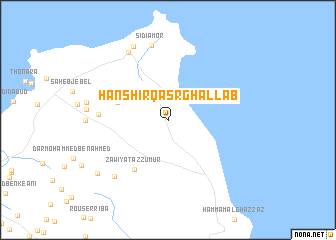
Hanshīr Qaşr Ghallāb (Tūnis al Janūbīyah, Tunisia)Hanshīr Qaşr Ghallāb is a town in the Tūnis al Janūbīyah region of Tunisia. An overview map of the region around Hanshīr Qaşr Ghallāb is displayed below.
regional and 3d topo map of Hanshīr Qaşr Ghallāb, Tunisia ::
Hanshīr Qaşr Ghallāb airports ::
The nearest airport is TUN - Tunis Carthage, located 74.8 km west of Hanshīr Qaşr Ghallāb.
Other airports nearby include PNL - Pantelleria (84.0 km east), MIR - Monastir Habib Bourguiba Intl (138.5 km south), TPS - Trapani Birgi (163.7 km north east), LMP - Lampedusa (216.9 km south east), Nearby towns ::
Dar el Jilani (4.9km north west) //
Zāwiyat az Zumūr (6.3km south west) //
Dar Mohammed Ben Mabrouk (6.3km west) //
Sidi Amor (8.5km north) //
El Haouaria (8.3km north west) //
Haj Mohammed Ben Hamid (8.0km south west) //
Sidi Aïssa (8.7km north) //
Dar Taleb Hassene (8.7km south west) //
[all distances 'as the bird flies' and approximate]  Places with similar names to Hanshīr Qaşr Ghallāb, Tunisia :: Disclaimer :: Information on this page comes without warranty of any kind |
||
|
Where is Hanshīr Qaşr Ghallāb? Elevation and coordinates ::
Latitude (lat): 36°59'0"N Longitude (lon): 11°3'0"E
Elevation (approx.): 18m (map arrows pan, magnifying glasses zoom) |
||
|
Visiting Hanshīr Qaşr Ghallāb? Hotel/Accommodation ::
Book a hotel in Hanshīr Qaşr Ghallāb Travel Guide ::
Buy a travel guide for Tunisia rental cars ::
car rental offers GPS waypoint ::
download a GPX waypoint (PoI) of Hanshīr Qaşr Ghallāb for your GPS receiver
|
||