|
search place name
|
||
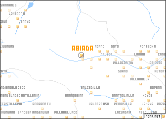
Abiada (Cantabria, Spain)Abiada is a town in the Cantabria region of Spain. An overview map of the region around Abiada is displayed below.
regional and 3d topo map of Abiada, Spain ::
Abiada airports ::
The nearest airport is SDR - Santander, located 59.1 km north east of Abiada.
Other airports nearby include BIO - Bilbao (116.0 km east), VIT - Vitoria (128.1 km east), VLL - Valladolid (152.9 km south), OVD - Aviles Asturias (154.6 km north west), Nearby towns ::
La Lomba (0.0km north) //
Villar (1.4km east) //
Entrambasaguas (1.4km east) //
La Hoz de Abiada (1.4km east) //
Mazandrero (2.3km south east) //
Celada de los Calderones (2.7km east) //
Proaño (3.3km north east) //
Naveda (4.1km east) //
Barrio (4.1km east) //
Ormas (4.5km north east) //
La Población de Suso (5.5km south east) //
Espinilla (5.4km east) //
La Serna (5.7km east) //
Soto (5.7km east) //
Salcedillo (7.5km south) //
[all distances 'as the bird flies' and approximate] 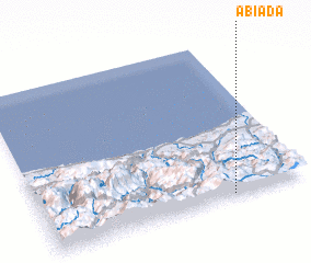 Places with similar names to Abiada, Spain ::
Disclaimer :: Information on this page comes without warranty of any kind |
||
|
Where is Abiada? Elevation and coordinates ::
Latitude (lat): 43°1'0"N Longitude (lon): 4°17'0"W
Elevation (approx.): 1040m (map arrows pan, magnifying glasses zoom) |
||
|
Visiting Abiada? Hotel/Accommodation ::
Book a hotel in Abiada Travel Guide ::
Buy a travel guide for Spain rental cars ::
car rental offers GPS waypoint ::
download a GPX waypoint (PoI) of Abiada for your GPS receiver
|
||