|
search place name
|
||
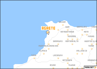
Agaete (Canarias, Spain)Agaete is a town in the Canarias region of Spain. An overview map of the region around Agaete is displayed below.
regional and 3d topo map of Agaete, Spain ::
Agaete airports ::
The nearest airport is LPA - Gran Canaria, located 37.0 km south east of Agaete.
Other airports nearby include TFN - Tenerife Norte (74.9 km north west), TFS - Tenerife Sur (86.1 km west), FUE - Fuerteventura (183.9 km east), Nearby towns ::
Sardina (1.9km north) //
Guayedra (3.7km south) //
San Isidro (3.8km north east) //
San Pedro (4.9km south east) //
Puerto de las Nieves (5.6km south) //
Gáldar (6.1km north east) //
Hoya de Pineda (6.5km east) //
Guia (6.8km east) //
Pico de Viento (6.8km east) //
El Risco (7.6km south) //
[all distances 'as the bird flies' and approximate] 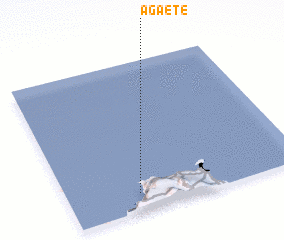 Places with similar names to Agaete, Spain ::
Disclaimer :: Information on this page comes without warranty of any kind |
||
|
Where is Agaete? Elevation and coordinates ::
Latitude (lat): 28°7'0"N Longitude (lon): 15°42'0"W
Elevation (approx.): 47m (map arrows pan, magnifying glasses zoom) |
||
|
Visiting Agaete? Hotel/Accommodation ::
Book a hotel in Agaete Travel Guide ::
Buy a travel guide for Spain rental cars ::
car rental offers GPS waypoint ::
download a GPX waypoint (PoI) of Agaete for your GPS receiver
|
||