|
search place name
|
||
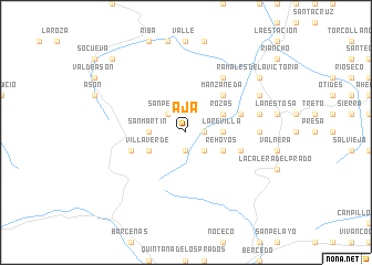
Aja (Cantabria, Spain)Aja is a town in the Cantabria region of Spain. An overview map of the region around Aja is displayed below.
regional and 3d topo map of Aja, Spain ::
Aja airports ::
The nearest airport is SDR - Santander, located 35.2 km north west of Aja.
Other airports nearby include BIO - Bilbao (50.5 km east), VIT - Vitoria (73.5 km south east), EAS - San Sebastian (141.2 km east), PNA - Pamplona (159.8 km east), Nearby towns ::
Regules (1.4km east) //
Villar (1.9km south) //
Veguilla (1.9km south) //
San Pedro (2.3km north west) //
Santayana (2.3km south east) //
Astrana (2.7km west) //
Hazas (2.7km west) //
San Martín (2.7km west) //
La Revilla (2.7km east) //
Villaverde (3.3km south west) //
Lavín (3.3km south west) //
Rozas (3.3km north east) //
Pilas (3.3km south east) //
Rehoyos (3.3km south east) //
Manzaneda (4.6km north east) //
Incedo (4.5km north east) //
Cañedo (4.5km south west) //
Valcaba (4.5km south west) //
Fresnedo (4.5km south east) //
Helguero (6.2km north east) //
Herada (5.4km east) //
San Juan (5.7km east) //
La Pared (6.6km north east) //
Ramales de la Victoria (7.8km north east) //
Rocías (9.2km north west) //
[all distances 'as the bird flies' and approximate] 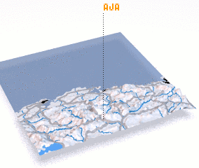 Places with similar names to Aja, Spain ::
Disclaimer :: Information on this page comes without warranty of any kind |
||
|
Where is Aja? Elevation and coordinates ::
Latitude (lat): 43°12'0"N Longitude (lon): 3°31'0"W
Elevation (approx.): 601m (map arrows pan, magnifying glasses zoom) |
||
|
Visiting Aja? Hotel/Accommodation ::
Book a hotel in Aja Travel Guide ::
Buy a travel guide for Spain rental cars ::
car rental offers GPS waypoint ::
download a GPX waypoint (PoI) of Aja for your GPS receiver
|
||