|
search place name
|
||
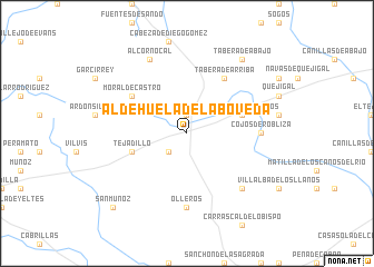
Aldehuela de la Bóveda (Castilla y León, Spain)Aldehuela de la Bóveda is a town in the Castilla y León region of Spain. An overview map of the region around Aldehuela de la Bóveda is displayed below.
regional and 3d topo map of Aldehuela de la Bóveda, Spain ::
Aldehuela de la Bóveda airports ::
The nearest airport is SLM - Salamanca, located 47.5 km east of Aldehuela de la Bóveda.
Other airports nearby include BGC - Braganca (124.7 km north west), VLL - Valladolid (138.3 km north east), VRL - Vila Real (148.1 km west), BJZ - Badajoz Talavera La Real (227.3 km south), Nearby towns ::
Castro-Enríquez (1.9km north) //
Sanchobueno (2.3km south west) //
Villar de los Álamos (4.6km north east) //
Rodasviejas (4.6km south west) //
Tejadillo (4.6km south west) //
Moral de Castro (5.6km north west) //
Tabera de Arriba (6.2km north east) //
Olleros (7.4km south) //
Cojos de Robliza (5.6km east) //
Monte Abajo (7.0km south east) //
Alcornocal (7.9km north) //
Tabera de Abajo (8.5km north east) //
San Muñoz (9.3km south west) //
[all distances 'as the bird flies' and approximate] 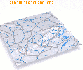 Places with similar names to Aldehuela de la Bóveda, Spain :: Disclaimer :: Information on this page comes without warranty of any kind |
||
|
Where is Aldehuela de la Bóveda? Elevation and coordinates ::
Latitude (lat): 40°51'0"N Longitude (lon): 6°3'0"W
Elevation (approx.): 783m (map arrows pan, magnifying glasses zoom) |
||
|
Visiting Aldehuela de la Bóveda? Hotel/Accommodation ::
Book a hotel in Aldehuela de la Bóveda Travel Guide ::
Buy a travel guide for Spain rental cars ::
car rental offers GPS waypoint ::
download a GPX waypoint (PoI) of Aldehuela de la Bóveda for your GPS receiver
|
||