|
search place name
|
||
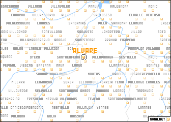
Alvaré (Asturias, Spain)Alvaré is a town in the Asturias region of Spain. An overview map of the region around Alvaré is displayed below.
regional and 3d topo map of Alvaré, Spain ::
Alvaré airports ::
The nearest airport is OVD - Aviles Asturias, located 21.6 km north of Alvaré.
Other airports nearby include BGC - Braganca (175.9 km south), VLL - Valladolid (214.0 km south east), Nearby towns ::
San Marcelo (0.0km north) //
El Fresno (1.3km east) //
Fuejo (1.3km east) //
Barca (1.3km west) //
Dóriga (1.9km north) //
Cutiellos (2.3km south west) //
Requejo (2.3km south west) //
Láneo (2.3km south west) //
Cabruñana (2.3km north east) //
Sobrerriba (2.3km north west) //
Dóriga (2.3km north west) //
Villapañada (2.7km east) //
Los Fornos (2.7km east) //
Santa Eufemia (2.7km west) //
San Esteban (3.7km north) //
Bulse (3.7km north) //
Moutas (3.9km south) //
Cornellana (3.9km north) //
Cañedo (4.6km south east) //
Miranda (4.6km south west) //
Folguerinas (4.6km north west) //
Sorribas (5.6km south) //
El Lobio (5.6km south) //
Borreras (4.0km west) //
Planadera (4.0km west) //
Acebedo (4.0km east) //
San Justo (5.6km north) //
Nava (4.4km south west) //
La Fueja (5.7km south) //
[all distances 'as the bird flies' and approximate] 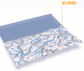 Places with similar names to Alvaré, Spain ::
Disclaimer :: Information on this page comes without warranty of any kind |
||
|
Where is Alvaré? Elevation and coordinates ::
Latitude (lat): 43°23'0"N Longitude (lon): 6°8'0"W
Elevation (approx.): 321m (map arrows pan, magnifying glasses zoom) |
||
|
Visiting Alvaré? Hotel/Accommodation ::
Book a hotel in Alvaré Travel Guide ::
Buy a travel guide for Spain rental cars ::
car rental offers GPS waypoint ::
download a GPX waypoint (PoI) of Alvaré for your GPS receiver
|
||