|
search place name
|
||
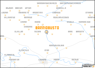
Barriobusto (País Vasco, Spain)Barriobusto is a town in the País Vasco region of Spain. An overview map of the region around Barriobusto is displayed below.
regional and 3d topo map of Barriobusto, Spain ::
Barriobusto airports ::
The nearest airport is VIT - Vitoria, located 42.5 km north west of Barriobusto.
Other airports nearby include PNA - Pamplona (68.4 km east), BIO - Bilbao (90.4 km north west), EAS - San Sebastian (102.2 km north east), BIQ - Biarritz-bayonne Anglet (124.7 km north east), Nearby towns ::
Labraza (1.4km east) //
Yécora (2.7km west) //
Lapoblación (3.9km north) //
Meano (4.6km north west) //
Moreda de Álava (6.2km south east) //
Marañón (7.4km north) //
Oyón (7.4km south) //
Viñaspre (5.8km west) //
Aguilar de Codés (6.9km north east) //
Cabredo (7.9km north) //
Angostina (7.9km north) //
Viana (7.8km south east) //
Bernedo (7.8km north west) //
[all distances 'as the bird flies' and approximate] 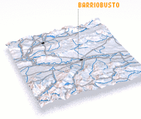 Places with similar names to Barriobusto, Spain ::
// Bărbeşti (RO)
// Berbeşti (RO)
// Berbeşti (RO)
// Berbeşti (RO)
// Bara Bāisdia (BD)
// Bārābasat (BD)
// Bara Bāsta (BD)
// Bir Abzet (TD)
// Barbastau (KZ)
// Bari Basti (PK)
Disclaimer :: Information on this page comes without warranty of any kind |
||
|
Where is Barriobusto? Elevation and coordinates ::
Latitude (lat): 42°34'0"N Longitude (lon): 2°26'0"W
Elevation (approx.): 601m (map arrows pan, magnifying glasses zoom) |
||
|
Visiting Barriobusto? Hotel/Accommodation ::
Book a hotel in Barriobusto Travel Guide ::
Buy a travel guide for Spain rental cars ::
car rental offers GPS waypoint ::
download a GPX waypoint (PoI) of Barriobusto for your GPS receiver
|
||