|
search place name
|
||
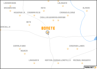
Bonete (Castilla-La Mancha, Spain)Bonete is a town in the Castilla-La Mancha region of Spain. An overview map of the region around Bonete is displayed below.
regional and 3d topo map of Bonete, Spain ::
Bonete airports ::
The nearest airport is ALC - Alicante, located 96.0 km south east of Bonete.
Other airports nearby include VLC - Valencia (100.8 km north east), MJV - Murcia San Javier (131.7 km south), Nearby towns ::
Casillas de Marín de Arriba (5.7km north) //
Casillas de Marín de Abajo (6.3km north east) //
Bete (6.9km north west) //
Casas Viejas (8.0km south east) //
Casa Aparicio (8.6km north west) //
Casa de Delgado (9.4km north east) //
[all distances 'as the bird flies' and approximate] 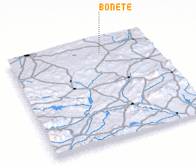 Places with similar names to Bonete, Spain ::
Disclaimer :: Information on this page comes without warranty of any kind |
||
|
Where is Bonete? Elevation and coordinates ::
Latitude (lat): 38°53'0"N Longitude (lon): 1°21'0"W
Elevation (approx.): 889m (map arrows pan, magnifying glasses zoom) |
||
|
Visiting Bonete? Hotel/Accommodation ::
Book a hotel in Bonete Travel Guide ::
Buy a travel guide for Spain rental cars ::
car rental offers GPS waypoint ::
download a GPX waypoint (PoI) of Bonete for your GPS receiver
|
||