|
search place name
|
||
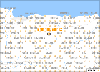
Brañaverniz (Asturias, Spain)Brañaverniz is a town in the Asturias region of Spain. An overview map of the region around Brañaverniz is displayed below.
regional and 3d topo map of Brañaverniz, Spain ::
Brañaverniz airports ::
The nearest airport is OVD - Aviles Asturias, located 38.9 km west of Brañaverniz.
Other airports nearby include SDR - Santander (141.5 km east), BGC - Braganca (203.3 km south west), VLL - Valladolid (206.0 km south), Nearby towns ::
Bárcena (1.3km east) //
Fonfría (1.3km east) //
La Olla (1.9km north) //
Candanal (2.3km south east) //
Pedroco (2.3km north west) //
Collado (3.7km south) //
El Valle (2.7km east) //
Casamorí (2.7km east) //
Peón (2.7km east) //
Pisones (3.7km north) //
Argañoso (3.9km south) //
Ríoseco (3.3km south west) //
Salientes (3.3km south west) //
Deva (3.3km north west) //
San Antonio (3.3km north west) //
San Miguel (3.9km north) //
Baldornón (4.6km south west) //
Santa Eulalia (4.6km south west) //
Sopeñas (4.6km south east) //
Morvís (4.6km south east) //
Cabueñes (4.6km north west) //
Fontica (4.6km north west) //
Cerredo (5.6km north) //
Cazamular (5.6km north) //
Fano (4.4km south west) //
Rozadas (4.4km south east) //
Cimadevilla (5.7km north) //
Serantes (4.4km north west) //
Santurio (4.4km north west) //
[all distances 'as the bird flies' and approximate] 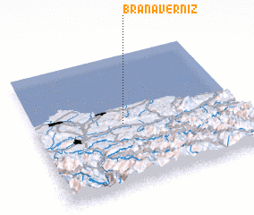 Places with similar names to Brañaverniz, Spain ::
// Brañaverniza (ES)
Disclaimer :: Information on this page comes without warranty of any kind |
||
|
Where is Brañaverniz? Elevation and coordinates ::
Latitude (lat): 43°29'0"N Longitude (lon): 5°34'0"W
Elevation (approx.): 362m (map arrows pan, magnifying glasses zoom) |
||
|
Visiting Brañaverniz? Hotel/Accommodation ::
Book a hotel in Brañaverniz Travel Guide ::
Buy a travel guide for Spain rental cars ::
car rental offers GPS waypoint ::
download a GPX waypoint (PoI) of Brañaverniz for your GPS receiver
|
||