|
search place name
|
||
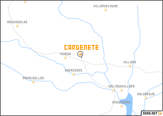
Cardenete (Castilla-La Mancha, Spain)Cardenete is a town in the Castilla-La Mancha region of Spain. An overview map of the region around Cardenete is displayed below.
regional and 3d topo map of Cardenete, Spain ::
Cardenete airports ::
The nearest airport is VLC - Valencia, located 107.7 km east of Cardenete.
Other airports nearby include TOJ - Madrid Torrejon (170.7 km north west), MAD - Madrid Barajas (179.7 km north west), ALC - Alicante (191.4 km south east), ZAZ - Zaragoza Ab (217.8 km north), Nearby towns ::
 Places with similar names to Cardenete, Spain ::
// Gartenöd (DE)
// Credinţa (RO)
// Corduente (ES)
// Kirti Noādda (BD)
// Kradente (GH)
// Kordāndeh (IR)
// Kortenda (NG)
// Cardinot (HT)
// Gardan Deh (AF)
// Gardan Deh (AF)
Disclaimer :: Information on this page comes without warranty of any kind |
||
|
Where is Cardenete? Elevation and coordinates ::
Latitude (lat): 39°46'0"N Longitude (lon): 1°41'0"W
Elevation (approx.): 966m (map arrows pan, magnifying glasses zoom) |
||
|
Visiting Cardenete? Hotel/Accommodation ::
Book a hotel in Cardenete Travel Guide ::
Buy a travel guide for Spain rental cars ::
car rental offers GPS waypoint ::
download a GPX waypoint (PoI) of Cardenete for your GPS receiver
|
||