|
search place name
|
||
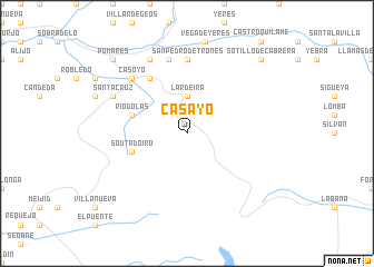
Casayo (Galicia, Spain)Casayo is a town in the Galicia region of Spain. An overview map of the region around Casayo is displayed below.
regional and 3d topo map of Casayo, Spain ::
Casayo airports ::
The nearest airport is BGC - Braganca, located 53.4 km south of Casayo.
Other airports nearby include VRL - Vila Real (140.3 km south west), SCQ - Santiago (146.5 km north west), OVD - Aviles Asturias (150.3 km north east), VGO - Vigo (151.1 km west), Nearby towns ::
Lardeira (3.7km north) //
Soutadoiro (4.5km south west) //
Ríodolas (4.5km north west) //
Portela (6.2km north west) //
San Pedro de Trones (7.4km north) //
Puente de Domingo Flórez (7.5km north) //
Casoyo (6.9km north west) //
Trigal (6.9km north west) //
Quereño (7.9km north) //
San Justo (7.9km north) //
Pusmazán (6.6km north west) //
Santa Cruz (6.6km north west) //
Sotillo de Cabrera (9.2km north east) //
Nogueiras (9.2km north west) //
Medua (9.2km north west) //
Pumares (9.2km north west) //
[all distances 'as the bird flies' and approximate]  Places with similar names to Casayo, Spain ::
Disclaimer :: Information on this page comes without warranty of any kind |
||
|
Where is Casayo? Elevation and coordinates ::
Latitude (lat): 42°20'0"N Longitude (lon): 6°48'0"W
Elevation (approx.): 767m (map arrows pan, magnifying glasses zoom) |
||
|
Visiting Casayo? Hotel/Accommodation ::
Book a hotel in Casayo Travel Guide ::
Buy a travel guide for Spain rental cars ::
car rental offers GPS waypoint ::
download a GPX waypoint (PoI) of Casayo for your GPS receiver
|
||