|
search place name
|
||
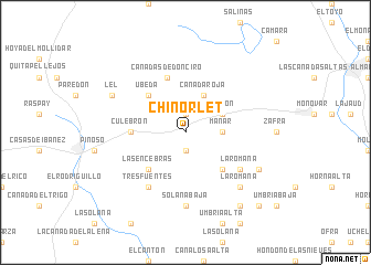
Chinorlet (Comunidad Valenciana, Spain)Chinorlet is a town in the Comunidad Valenciana region of Spain. An overview map of the region around Chinorlet is displayed below.
regional and 3d topo map of Chinorlet, Spain ::
Chinorlet airports ::
The nearest airport is ALC - Alicante, located 37.4 km south east of Chinorlet.
Other airports nearby include MJV - Murcia San Javier (72.2 km south), VLC - Valencia (125.8 km north), LEI - Almeria (214.9 km south west), Nearby towns ::
Derramador (1.9km north) //
Casas del Señor (1.9km south) //
Mañar (2.9km east) //
Hondón (3.4km north east) //
Cañada Roja (4.0km north) //
Úbeda (4.7km north west) //
Alforins (4.7km south east) //
Cavafría (4.7km south east) //
Las Encebras (4.7km south west) //
Culebrón (4.4km west) //
Cañadas de Don Ciro (5.7km north) //
Tresfuentes (6.3km south west) //
La Romana (5.7km south east) //
Solana Alta (7.4km south) //
Solana Baja (7.4km south) //
La Romana (7.1km south east) //
Lel (6.9km north west) //
Falcones (6.9km south east) //
Las Cuevas (8.6km south east) //
Pomares (9.4km south east) //
[all distances 'as the bird flies' and approximate] 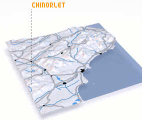 Places with similar names to Chinorlet, Spain :: Disclaimer :: Information on this page comes without warranty of any kind |
||
|
Where is Chinorlet? Elevation and coordinates ::
Latitude (lat): 38°25'0"N Longitude (lon): 0°57'0"W
Elevation (approx.): 532m (map arrows pan, magnifying glasses zoom) |
||
|
Visiting Chinorlet? Hotel/Accommodation ::
Book a hotel in Chinorlet Travel Guide ::
Buy a travel guide for Spain rental cars ::
car rental offers GPS waypoint ::
download a GPX waypoint (PoI) of Chinorlet for your GPS receiver
|
||