|
search place name
|
||
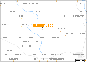
El Berrueco (Andalucía, Spain)El Berrueco is a town in the Andalucía region of Spain. An overview map of the region around El Berrueco is displayed below.
regional and 3d topo map of El Berrueco, Spain ::
El Berrueco airports ::
The nearest airport is GRX - Granada, located 76.5 km south of El Berrueco.
Other airports nearby include ODB - Cordoba (80.6 km west), GRX - Granada Armilla (85.6 km south), AGP - Malaga (141.5 km south), OZP - Sevilla Moron Ab (167.4 km south west), Nearby towns ::
La Muña (3.7km south) //
La Iglesia (5.7km south east) //
Fuerte del Rey (5.9km east) //
La Torre María Martín (7.1km north east) //
Puente del Villar (7.1km south west) //
Corbunillo (8.0km north) //
Villardompardo (6.9km south west) //
Gil Alonso (9.4km south west) //
[all distances 'as the bird flies' and approximate]  Places with similar names to El Berrueco, Spain ::
// El Brouga (MA)
// Eilberg (DE)
// Ellaberg (DE)
// El Abrigo (ES)
// El Berrueco (ES)
// El Burgo (ES)
// Elburgo (ES)
// El Burrueco (ES)
// Elbrook (US)
// El Barco (CL)
Disclaimer :: Information on this page comes without warranty of any kind |
||
|
Where is El Berrueco? Elevation and coordinates ::
Latitude (lat): 37°52'0"N Longitude (lon): 3°56'0"W
Elevation (approx.): 394m (map arrows pan, magnifying glasses zoom) |
||
|
Visiting El Berrueco? Hotel/Accommodation ::
Book a hotel in El Berrueco Travel Guide ::
Buy a travel guide for Spain rental cars ::
car rental offers GPS waypoint ::
download a GPX waypoint (PoI) of El Berrueco for your GPS receiver
|
||