|
search place name
|
||
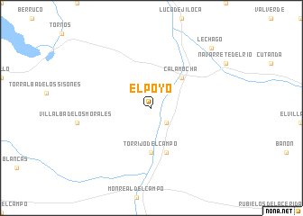
El Poyo (Aragón, Spain)El Poyo is a town in the Aragón region of Spain. An overview map of the region around El Poyo is displayed below.
regional and 3d topo map of El Poyo, Spain ::
El Poyo airports ::
The nearest airport is ZAZ - Zaragoza Ab, located 90.3 km north of El Poyo.
Other airports nearby include VLC - Valencia (170.9 km south east), PNA - Pamplona (211.2 km north), VIT - Vitoria (250.3 km north west), Nearby towns ::
Fuentes Claras (2.3km south east) //
Calamocha (4.6km north east) //
Torrijo del Campo (5.6km south) //
Caminreal (5.7km south) //
Lechago (9.3km north east) //
[all distances 'as the bird flies' and approximate] 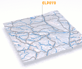 Places with similar names to El Poyo, Spain ::
Disclaimer :: Information on this page comes without warranty of any kind |
||
|
Where is El Poyo? Elevation and coordinates ::
Latitude (lat): 40°53'0"N Longitude (lon): 1°20'0"W
Elevation (approx.): 915m (map arrows pan, magnifying glasses zoom) |
||
|
Visiting El Poyo? Hotel/Accommodation ::
Book a hotel in El Poyo Travel Guide ::
Buy a travel guide for Spain rental cars ::
car rental offers GPS waypoint ::
download a GPX waypoint (PoI) of El Poyo for your GPS receiver
|
||