|
search place name
|
||
Entrepeñas (Asturias, Spain)Entrepeñas is a town in the Asturias region of Spain. An overview map of the region around Entrepeñas is displayed below.
regional and 3d topo map of Entrepeñas, Spain ::

Entrepeñas airports ::
The nearest airport is OVD - Aviles Asturias, located 34.4 km north west of Entrepeñas.
Other airports nearby include SDR - Santander (156.7 km east), BGC - Braganca (181.8 km south west), VLL - Valladolid (195.2 km south), Nearby towns ::
Las Quintanas (0.0km north) //
La Cueva (0.0km north) //
Box (1.3km west) //
Frieres (1.3km east) //
Argollanes (1.3km west) //
El Viso (2.3km south east) //
Mieres (2.3km north west) //
Solad (2.3km north east) //
Paranza (2.3km north east) //
Riaño (2.7km east) //
Naves (2.7km west) //
La Pasera (2.7km east) //
Tiñana (3.7km north) //
Peña Rubia (3.3km south east) //
Anieves (3.3km south west) //
Santianes (3.3km south east) //
El Carmen (3.9km south) //
Cotorraso (3.9km south) //
Cuclillos (3.9km north) //
Fueyo (3.9km north) //
Campo (3.9km north) //
Fozana (3.9km north) //
Cimalavilla (4.6km south east) //
San Miguel (4.6km south east) //
Vallina (4.6km north east) //
Limanes (4.6km north west) //
Hevia (4.6km north east) //
San Tirso (5.6km south) //
Acebal (4.0km east) //
[all distances 'as the bird flies' and approximate] 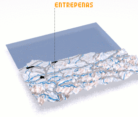 Places with similar names to Entrepeñas, Spain ::
// Entrepeñas (ES)
// Entrepeñas (ES)
Disclaimer :: Information on this page comes without warranty of any kind |
||
|
Where is Entrepeñas? Elevation and coordinates ::
Latitude (lat): 43°20'0"N Longitude (lon): 5°45'0"W
Elevation (approx.): 286m (map arrows pan, magnifying glasses zoom) |
||
|
Visiting Entrepeñas? Hotel/Accommodation ::
Book a hotel in Entrepeñas Travel Guide ::
Buy a travel guide for Spain rental cars ::
car rental offers GPS waypoint ::
download a GPX waypoint (PoI) of Entrepeñas for your GPS receiver
|
||