|
search place name
|
||
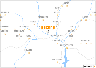
Escané (Aragón, Spain)Escané is a town in the Aragón region of Spain. An overview map of the region around Escané is displayed below.
regional and 3d topo map of Escané, Spain ::
Escané airports ::
The nearest airport is LEU - Seo De Urgel, located 61.0 km east of Escané.
Other airports nearby include LDE - Tarbes Lourdes (98.7 km north west), LRH - La Rochelle Lherm (120.6 km north east), PUF - Pau Pyrenees (137.0 km north west), TLS - Toulouse Blagnac (142.2 km north east), Nearby towns ::
Noales (2.3km north west) //
Bíbiles (2.3km south west) //
Bonansa (2.3km south west) //
Montanúy (2.3km north east) //
Sarroqueta (3.3km south east) //
Ginasté (4.6km north east) //
Vilaller (4.6km north east) //
Gabarret (4.6km south east) //
Castanesa (5.7km north) //
Denúy (5.5km north west) //
Suils (5.8km west) //
Alíns (5.8km west) //
Estet (7.9km north) //
Pont de Suert (7.8km south east) //
Calvera (9.2km south west) //
[all distances 'as the bird flies' and approximate] 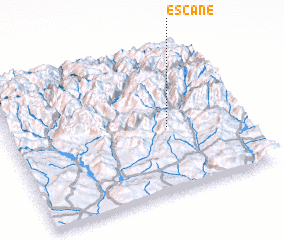 Places with similar names to Escané, Spain ::
Disclaimer :: Information on this page comes without warranty of any kind |
||
|
Where is Escané? Elevation and coordinates ::
Latitude (lat): 42°27'0"N Longitude (lon): 0°41'0"W
Elevation (approx.): 1165m (map arrows pan, magnifying glasses zoom) |
||
|
Visiting Escané? Hotel/Accommodation ::
Book a hotel in Escané Travel Guide ::
Buy a travel guide for Spain rental cars ::
car rental offers GPS waypoint ::
download a GPX waypoint (PoI) of Escané for your GPS receiver
|
||