|
search place name
|
||
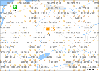
Fanes (Asturias, Spain)Fanes is a town in the Asturias region of Spain. An overview map of the region around Fanes is displayed below.
regional and 3d topo map of Fanes, Spain ::
Fanes airports ::
The nearest airport is OVD - Aviles Asturias, located 14.4 km north west of Fanes.
Other airports nearby include BGC - Braganca (190.1 km south), VLL - Valladolid (214.2 km south east), Nearby towns ::
Villayo (1.3km west) //
Llanera (1.3km west) //
Barredo (1.9km north) //
Anduerga (1.9km south) //
Granda (1.9km south) //
Carbajal (1.9km south) //
Lavares (2.3km north east) //
Arlós (2.3km north east) //
Bonielles (2.3km south east) //
Premió (2.7km west) //
Panizales (2.7km east) //
Venero (3.9km north) //
Pedregal de Taborneda (3.9km north) //
Villanueva (3.3km south west) //
Agüera (3.3km south west) //
Carcabón (3.3km south west) //
Carbayal (3.9km north) //
Biedes (3.9km south) //
Noval (3.3km north east) //
Friera (4.6km north west) //
Villanueva (4.6km south east) //
Llanera (4.6km south east) //
Juncedo-Campo (5.6km north) //
Jugal (5.7km south) //
Marinas (5.7km south) //
Ferroñes (4.4km north east) //
Brañes (5.7km south) //
Agüera (5.7km south) //
Las Cruces (4.4km south west) //
[all distances 'as the bird flies' and approximate] 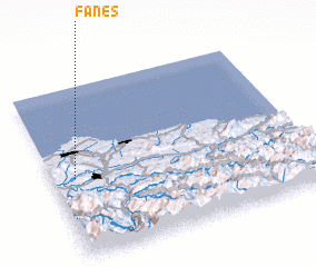 Places with similar names to Fanes, Spain ::
Disclaimer :: Information on this page comes without warranty of any kind |
||
|
Where is Fanes? Elevation and coordinates ::
Latitude (lat): 43°28'0"N Longitude (lon): 5°55'0"W
Elevation (approx.): 389m (map arrows pan, magnifying glasses zoom) |
||
|
Visiting Fanes? Hotel/Accommodation ::
Book a hotel in Fanes Travel Guide ::
Buy a travel guide for Spain rental cars ::
car rental offers GPS waypoint ::
download a GPX waypoint (PoI) of Fanes for your GPS receiver
|
||