|
search place name
|
||
Garayolza (País Vasco, Spain)Garayolza is a town in the País Vasco region of Spain. An overview map of the region around Garayolza is displayed below.
regional and 3d topo map of Garayolza, Spain ::

Garayolza airports ::
The nearest airport is BIO - Bilbao, located 6.6 km west of Garayolza.
Other airports nearby include VIT - Vitoria (45.4 km south), SDR - Santander (81.6 km west), EAS - San Sebastian (85.0 km east), BIQ - Biarritz-bayonne Anglet (108.1 km east), Nearby towns ::
La Cruz (0.0km north) //
Goitiolza (1.3km east) //
Santa María de Lezama (1.9km south) //
Arechalde (1.9km south) //
Zamudio (2.7km west) //
Loroños (3.3km south east) //
Larrabezúa (3.3km south east) //
Llerana (3.3km south east) //
Elguézabal (3.9km north) //
Derio (3.3km north west) //
Sarricolea (4.6km south east) //
Fica (4.6km north east) //
Galdácano (5.6km south) //
La Cruz (5.6km south) //
Gámiz (5.7km north) //
Ergoyen (5.7km north) //
Goicolegea (4.5km south east) //
Urgoiti (5.7km south) //
Bequea (5.7km south) //
Basozábal (5.7km north) //
Bengoeche-Aperribay (5.7km south) //
Lequizamón (5.5km south west) //
Maurolas (6.2km north west) //
Botiolas (5.5km north east) //
Urbi (6.2km south west) //
Arcocha (6.2km south west) //
Astorecas (5.4km east) //
Munguía (7.4km north) //
Iturribálzaga (7.4km north) //
[all distances 'as the bird flies' and approximate] 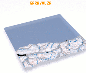 Places with similar names to Garayolza, Spain ::
// Corryolus (IE)
Disclaimer :: Information on this page comes without warranty of any kind |
||
|
Where is Garayolza? Elevation and coordinates ::
Latitude (lat): 43°17'0"N Longitude (lon): 2°50'0"W
Elevation (approx.): 66m (map arrows pan, magnifying glasses zoom) |
||
|
Visiting Garayolza? Hotel/Accommodation ::
Book a hotel in Garayolza Travel Guide ::
Buy a travel guide for Spain rental cars ::
car rental offers GPS waypoint ::
download a GPX waypoint (PoI) of Garayolza for your GPS receiver
|
||