|
search place name
|
||
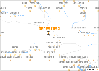
Genestosa (Castilla y León, Spain)Genestosa is a town in the Castilla y León region of Spain. An overview map of the region around Genestosa is displayed below.
regional and 3d topo map of Genestosa, Spain ::
Genestosa airports ::
The nearest airport is OVD - Aviles Asturias, located 60.8 km north of Genestosa.
Other airports nearby include BGC - Braganca (140.7 km south west), VLL - Valladolid (174.3 km south east), VRL - Vila Real (239.3 km south west), Nearby towns ::
Torrebarrio (1.4km east) //
La Majua (3.7km south) //
Villargusán (3.3km south east) //
Candemuela (3.9km south) //
Torrestío (4.6km north west) //
Pinos (4.6km south east) //
San Emiliano (5.7km south) //
Cospedal (6.2km south west) //
Villasecino (7.4km south) //
Robledo (6.9km south west) //
Villafeliz (7.9km south) //
Huergas (9.2km south west) //
[all distances 'as the bird flies' and approximate]  Places with similar names to Genestosa, Spain ::
// Jaunsētas (LV)
// Genestacio (ES)
// Genestaza (ES)
// Genestosa (ES)
// Genestoso (ES)
// Juan Nestoso (MX)
// Ginestas (FR)
// Ginestous (FR)
Disclaimer :: Information on this page comes without warranty of any kind |
||
|
Where is Genestosa? Elevation and coordinates ::
Latitude (lat): 43°1'0"N Longitude (lon): 6°1'0"W
Elevation (approx.): 1292m (map arrows pan, magnifying glasses zoom) |
||
|
Visiting Genestosa? Hotel/Accommodation ::
Book a hotel in Genestosa Travel Guide ::
Buy a travel guide for Spain rental cars ::
car rental offers GPS waypoint ::
download a GPX waypoint (PoI) of Genestosa for your GPS receiver
|
||