|
search place name
|
||
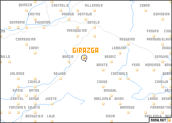
Girazga (Galicia, Spain)Girazga is a town in the Galicia region of Spain. An overview map of the region around Girazga is displayed below.
regional and 3d topo map of Girazga, Spain ::
Girazga airports ::
The nearest airport is VGO - Vigo, located 36.5 km south west of Girazga.
Other airports nearby include SCQ - Santiago (48.4 km north), LCG - La Coruna A Coruna (92.9 km north), OPO - Porto (138.7 km south), VRL - Vila Real (141.4 km south), Nearby towns ::
Barcia (2.7km west) //
Baiste (3.3km south east) //
Beáriz (4.1km east) //
Presqueira (5.7km north) //
Pardesoa (5.7km north) //
Seijido (5.5km south west) //
Couso (6.2km south east) //
Presqueira (7.5km north) //
Magdalena (7.5km north) //
Sotelo (7.5km north) //
Lebozán (5.8km east) //
Córcores (6.6km south east) //
Amiudal (8.5km south east) //
[all distances 'as the bird flies' and approximate] 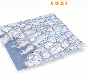 Places with similar names to Girazga, Spain ::
Disclaimer :: Information on this page comes without warranty of any kind |
||
|
Where is Girazga? Elevation and coordinates ::
Latitude (lat): 42°28'0"N Longitude (lon): 8°19'0"W
Elevation (approx.): 607m (map arrows pan, magnifying glasses zoom) |
||
|
Visiting Girazga? Hotel/Accommodation ::
Book a hotel in Girazga Travel Guide ::
Buy a travel guide for Spain rental cars ::
car rental offers GPS waypoint ::
download a GPX waypoint (PoI) of Girazga for your GPS receiver
|
||