|
search place name
|
||
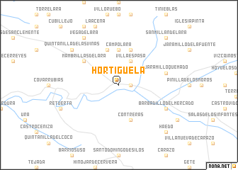
Hortigüela (Castilla y León, Spain)Hortigüela is a town in the Castilla y León region of Spain. An overview map of the region around Hortigüela is displayed below.
regional and 3d topo map of Hortigüela, Spain ::
Hortigüela airports ::
The nearest airport is VIT - Vitoria, located 107.0 km north east of Hortigüela.
Other airports nearby include VLL - Valladolid (125.7 km west), BIO - Bilbao (143.3 km north), SDR - Santander (154.7 km north), PNA - Pamplona (165.3 km north east), Nearby towns ::
Cascajares de la Sierra (1.4km east) //
Villaespasa (4.0km north) //
Campolara (5.6km north) //
Lara de los Infantes (5.7km north) //
Contreras (5.7km south) //
Rupelo (5.7km north) //
Mambrillas de Lara (5.5km north west) //
Jaramillo Quemado (5.8km east) //
Barbadillo del Mercado (6.6km south east) //
Vega de Lara (8.5km north west) //
Quintanilla de las Viñas (7.8km north west) //
San Millán de Lara (9.2km north east) //
Haedo (9.2km south east) //
[all distances 'as the bird flies' and approximate] 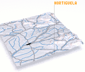 Places with similar names to Hortigüela, Spain ::
// Hortigal (ES)
// Herţeh Kolā (IR)
// Hortigal (PE)
// Hūrt ‘Āgūl (IR)
// Hartikkala (FI)
// Hartikkala (FI)
// Hartikkala (FI)
Disclaimer :: Information on this page comes without warranty of any kind |
||
|
Where is Hortigüela? Elevation and coordinates ::
Latitude (lat): 42°4'0"N Longitude (lon): 3°25'0"W
Elevation (approx.): 922m (map arrows pan, magnifying glasses zoom) |
||
|
Visiting Hortigüela? Hotel/Accommodation ::
Book a hotel in Hortigüela Travel Guide ::
Buy a travel guide for Spain rental cars ::
car rental offers GPS waypoint ::
download a GPX waypoint (PoI) of Hortigüela for your GPS receiver
|
||