|
search place name
|
||
La Umbría de Arriba (Andalucía, Spain)La Umbría de Arriba is a town in the Andalucía region of Spain. An overview map of the region around La Umbría de Arriba is displayed below.
regional and 3d topo map of La Umbría de Arriba, Spain ::

La Umbría de Arriba airports ::
The nearest airport is LEI - Almeria, located 76.7 km south of La Umbría de Arriba.
Other airports nearby include GRX - Granada Armilla (125.0 km west), GRX - Granada (134.9 km west), MJV - Murcia San Javier (135.4 km east), ALC - Alicante (175.6 km north east), Nearby towns ::
Los Álamos (1.5km west) //
La Aspilla (3.7km north) //
Oria (5.8km south) //
La Fuente del Negro (6.3km south west) //
Róquez (5.8km north east) //
Chirivel (7.1km north east) //
El Contador (7.1km north west) //
El Chaparral Alto (8.1km south west) //
Las Vertientes (9.5km north west) //
[all distances 'as the bird flies' and approximate] 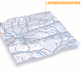 Places with similar names to La Umbría de Arriba, Spain :: Disclaimer :: Information on this page comes without warranty of any kind |
||
|
Where is La Umbría de Arriba? Elevation and coordinates ::
Latitude (lat): 37°32'0"N Longitude (lon): 2°19'0"W
Elevation (approx.): 1110m (map arrows pan, magnifying glasses zoom) |
||
|
Visiting La Umbría de Arriba? Hotel/Accommodation ::
Book a hotel in La Umbría de Arriba Travel Guide ::
Buy a travel guide for Spain rental cars ::
car rental offers GPS waypoint ::
download a GPX waypoint (PoI) of La Umbría de Arriba for your GPS receiver
|
||