|
search place name
|
||
Lomopardo (Andalucía, Spain)Lomopardo is a town in the Andalucía region of Spain. An overview map of the region around Lomopardo is displayed below.
regional and 3d topo map of Lomopardo, Spain ::
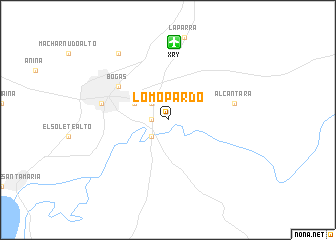
Lomopardo airports ::
The nearest airport is XRY - Jerez, located 8.7 km north of Lomopardo.
Other airports nearby include OZP - Sevilla Moron Ab (69.2 km north east), SVQ - Sevilla (84.8 km north), GIB - Gibraltar (86.1 km south east), TNG - Tanger Ibn Batouta (105.1 km south), Nearby towns ::
Montealegre Alto (1.5km west) //
Albaladejo (2.4km north west) //
La Cartuja (2.4km south west) //
Las Abiertas (3.5km north west) //
Bogás (5.8km north west) //
Jerez de la Frontera (6.2km west) //
Alcántara (6.2km east) //
El Carrascal (8.7km north west) //
[all distances 'as the bird flies' and approximate]  Places with similar names to Lomopardo, Spain ::
// Limau Purut (MY)
// Loma Prieta (PA)
// Lompirt (RO)
// Loma Parda (US)
// Limeport (US)
// La Maporita (CO)
// Limaupurut (ID)
// Loma Parada (MX)
// Loma Prieta (MX)
// Loma Prieta (MX)
Disclaimer :: Information on this page comes without warranty of any kind |
||
|
Where is Lomopardo? Elevation and coordinates ::
Latitude (lat): 36°40'0"N Longitude (lon): 6°4'0"W
Elevation (approx.): 38m (map arrows pan, magnifying glasses zoom) |
||
|
Visiting Lomopardo? Hotel/Accommodation ::
Book a hotel in Lomopardo Travel Guide ::
Buy a travel guide for Spain rental cars ::
car rental offers GPS waypoint ::
download a GPX waypoint (PoI) of Lomopardo for your GPS receiver
|
||