|
search place name
|
||
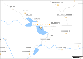
Loriguilla (Comunidad Valenciana, Spain)Loriguilla is a town in the Comunidad Valenciana region of Spain. An overview map of the region around Loriguilla is displayed below.
regional and 3d topo map of Loriguilla, Spain ::
Loriguilla airports ::
The nearest airport is VLC - Valencia, located 43.1 km south east of Loriguilla.
Other airports nearby include ALC - Alicante (158.6 km south), MJV - Murcia San Javier (212.0 km south), ZAZ - Zaragoza Ab (220.5 km north), Nearby towns ::
Domeño (4.0km north) //
La Ermita (4.7km south east) //
Chulilla (4.7km south east) //
Losa del Obispo (4.7km north east) //
Sot de Chera (5.7km south) //
Calles (7.0km north west) //
Chelva (9.4km north west) //
[all distances 'as the bird flies' and approximate] 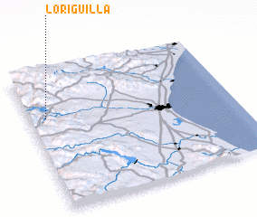 Places with similar names to Loriguilla, Spain ::
// Liergl (AT)
// Loreggiola (IT)
// Louriçal (PT)
// Lauragali (LV)
// Lāhri Kili (PK)
// Lār Qila (PK)
// Lora Kili (PK)
// Lora Kili (PK)
// Larquillo (PE)
// La Argolla (NI)
Disclaimer :: Information on this page comes without warranty of any kind |
||
|
Where is Loriguilla? Elevation and coordinates ::
Latitude (lat): 39°41'0"N Longitude (lon): 0°55'0"W
Elevation (approx.): 525m (map arrows pan, magnifying glasses zoom) |
||
|
Visiting Loriguilla? Hotel/Accommodation ::
Book a hotel in Loriguilla Travel Guide ::
Buy a travel guide for Spain rental cars ::
car rental offers GPS waypoint ::
download a GPX waypoint (PoI) of Loriguilla for your GPS receiver
|
||