|
search place name
|
||
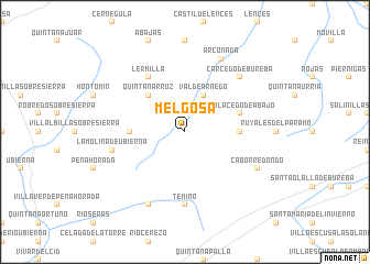
Melgosa (Castilla y León, Spain)Melgosa is a town in the Castilla y León region of Spain. An overview map of the region around Melgosa is displayed below.
regional and 3d topo map of Melgosa, Spain ::
Melgosa airports ::
The nearest airport is VIT - Vitoria, located 78.0 km north east of Melgosa.
Other airports nearby include BIO - Bilbao (100.0 km north east), SDR - Santander (101.7 km north), VLL - Valladolid (141.5 km south west), PNA - Pamplona (158.3 km east), Nearby towns ::
Valdearnedo (4.0km north) //
Quintanarruz (4.6km north west) //
Rublacedo de Arriba (4.1km east) //
Cobos Junto a la Molina (4.1km west) //
Rublacedo de Abajo (4.5km north east) //
Lermilla (6.2km north west) //
Temiño (7.4km south) //
La Molina de Ubierna (5.8km west) //
Carcedo de Bureba (6.9km north east) //
Robredo-Temiño (7.9km south) //
Arconada (7.9km north) //
Caborredondo (6.6km south east) //
[all distances 'as the bird flies' and approximate] 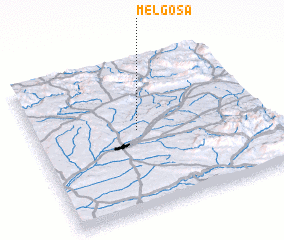 Places with similar names to Melgosa, Spain ::
Disclaimer :: Information on this page comes without warranty of any kind |
||
|
Where is Melgosa? Elevation and coordinates ::
Latitude (lat): 42°32'0"N Longitude (lon): 3°33'0"W
Elevation (approx.): 795m (map arrows pan, magnifying glasses zoom) |
||
|
Visiting Melgosa? Hotel/Accommodation ::
Book a hotel in Melgosa Travel Guide ::
Buy a travel guide for Spain rental cars ::
car rental offers GPS waypoint ::
download a GPX waypoint (PoI) of Melgosa for your GPS receiver
|
||