|
search place name
|
||
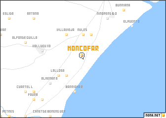
Moncófar (Comunidad Valenciana, Spain)Moncófar is a town in the Comunidad Valenciana region of Spain. An overview map of the region around Moncófar is displayed below.
regional and 3d topo map of Moncófar, Spain ::
nearby GPS traces from timatio ::
Moncófar airports ::
The nearest airport is VLC - Valencia, located 44.7 km south west of Moncófar.
Other airports nearby include IBZ - Ibiza (166.8 km south east), ALC - Alicante (172.2 km south), REU - Reus (186.7 km north east), ZAZ - Zaragoza Ab (220.5 km north), Nearby towns ::
Chilches (4.7km south west) //
Nules (5.6km north) //
Mascarell (5.7km north) //
La Llosa (5.7km south west) //
Villavieja (6.2km north west) //
Barrio-Mar (7.5km south) //
Almenara (8.0km south west) //
[all distances 'as the bird flies' and approximate]  Places with similar names to Moncófar, Spain ::
// Manggafura (ID)
// Munkkivuori (FI)
Disclaimer :: Information on this page comes without warranty of any kind |
||
|
Where is Moncófar? Elevation and coordinates ::
Latitude (lat): 39°48'0"N Longitude (lon): 0°9'0"W
Elevation (approx.): 6m (map arrows pan, magnifying glasses zoom) |
||
|
Visiting Moncófar? Hotel/Accommodation ::
Book a hotel in Moncófar Travel Guide ::
Buy a travel guide for Spain rental cars ::
car rental offers GPS waypoint ::
download a GPX waypoint (PoI) of Moncófar for your GPS receiver
|
||