|
search place name
|
||
Montealegre (Castilla y León, Spain)Montealegre is a town in the Castilla y León region of Spain. An overview map of the region around Montealegre is displayed below.
regional and 3d topo map of Montealegre, Spain ::

Montealegre airports ::
The nearest airport is VLL - Valladolid, located 21.9 km south of Montealegre.
Other airports nearby include SLM - Salamanca (116.7 km south west), BGC - Braganca (150.1 km west), SDR - Santander (191.3 km north east), MAD - Madrid Barajas (192.1 km south east), Nearby towns ::
Palacios de Campos (4.1km west) //
Meneses de Campos (5.7km north) //
Villalba de los Alcores (5.6km south east) //
Villerías (6.9km north east) //
Valdenebro de los Valles (7.8km south west) //
[all distances 'as the bird flies' and approximate] 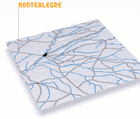 Places with similar names to Montealegre, Spain ::
// Montalegre (PT)
// Monte Alegre (PT)
// Monte Alegre (PT)
// Monte Alegre (CU)
// Montealegre (ES)
// Môndól Kiri (KH)
// Monte Alegre (CO)
// Montealegre (CO)
// Māndalgarh (IN)
// Monte Alegre (MX)
Disclaimer :: Information on this page comes without warranty of any kind |
||
|
Where is Montealegre? Elevation and coordinates ::
Latitude (lat): 41°54'0"N Longitude (lon): 4°54'0"W
Elevation (approx.): 790m (map arrows pan, magnifying glasses zoom) |
||
|
Visiting Montealegre? Hotel/Accommodation ::
Book a hotel in Montealegre Travel Guide ::
Buy a travel guide for Spain rental cars ::
car rental offers GPS waypoint ::
download a GPX waypoint (PoI) of Montealegre for your GPS receiver
|
||